Mesoscale and microscale climate modeling
Climate modeling is not only possible on the global/planetary scale, but also on the microscale level. To simulate climate variations at this level, the Institute of Meteorology at the University of Hamburg has developed two models METRAS and MITRAS, which specifically focus on mesoscale and microscale climate simulations.
MITRAS is able to simulate climate variations for an area of 100m² to 1000m², and is therefore very well suited to simulate suburbs and small cities. This is especially interesting to simulate the effects that different buildings have on the climate in a city, or to see the positive effects of a lake or park within the city confines.
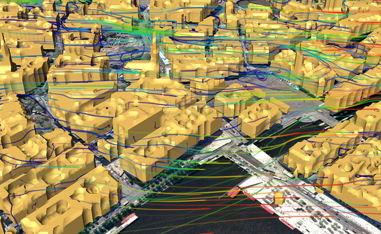
The following two animations show a visualization of wind blowing from east to west in the inner parts of the city of Hamburg. In the front one can see parts of the Binnenalster (lake), while in the back, parts of the Speicherstadt at the river Elbe can be seen.
Wind is visualized using animated streamlines, while color is used to map wind magnitude in m/s. An additional LIC plane moves through the city and displays a cross section of the wind field.
Particle Tracing
In the visualization below, only those streamlines are visualized whose path crosses through a common point, in this case a virtual red sphere that is located on a plane in front of the city hall of Hamburg. The visualization shows where the wind at this point is coming from and how the particles are distributed to the right.
For more information about this model and these simulations, please see also the MITRAS project website.