Cropland expansion 800 - 2100
The animation shows the development of the global cropland distribution for the period AD 800 to 2100. The colors show the percentage of the respective areas covered with cropland. The data has been reconstructed by the Max-Planck-Institute for Meteorology by combining information on the land use of the last centuries with population data for the last millennium. (Source: Pongratz, J., C. Reick, T. Raddatz, and M. Claussen (2008), A reconstruction of global agricultural areas and land cover for the last millennium, Global Biogeochem. Cycles, 22, GB3018, doi:10.1029/2007GB003153). The projections for 2000-2100 are based on IPCC scenario A1B ( IPCC Special Report "Emission Scenarios", 2000).
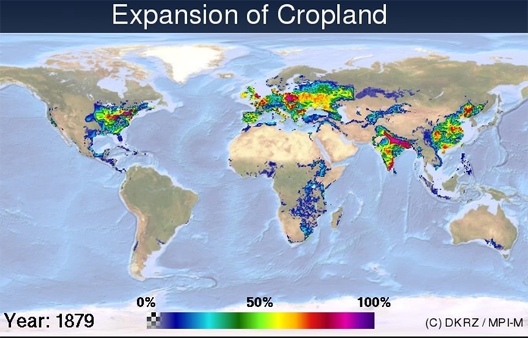
Cropland expansion 1860 - 2100
For better depiction, the period AD 1860 to 2100 of the animation above is shown in "slow motion". Again, the colors show the percentage of the respective areas covered with cropland. For more information please read the text above. (Source: Pongratz, J., C. Reick, T. Raddatz, and M. Claussen (2008), A reconstruction of global agricultural areas and land cover for the last millennium, Global Biogeochem. Cycles, 22, GB3018, doi:10.1029/2007GB003153).