Modeling of regional phenomena requires high spatial resolution of both the boundary condition data and the numerical model itself. Regional models provide the required resolution at relatively low computational costs.
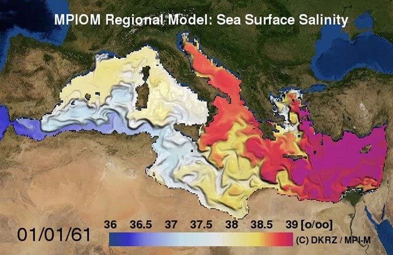
This visualization shows the salinity of the surface layer of the Mediterranean Sea as simulated with a regional version of the ocean circulation model MPIOM. The Mediterranean Sea is a semi-enclosed basin in the subtropics and characterized by strong net evaporation. Thus, the salinity is higher than in the Atlantic. The inflow of less saline water from the Atlantic Ocean through the Strait of Gibraltar can easily be depicted. Similarly, an inflow of low saline water from the Black Sea affects the Aegean Sea. The animation also shows the influence of different meteorological conditions on the currents and eddies.
This animation lasts over 3 model years. The curvilinear model grid has a horizontal resolution of about 8 to 10 km and 29 levels in the vertical. The atmospheric and hydrologic boundary conditions were derived from a simulation with the regional climate model REMO.
Data: Uwe Mikolajewicz, MPI for Meteorology